
URL: http://www.nationsonline.org/oneworld/map/USA/california_map.htm.
This is a reference map of transportation routes in California. The map gives us a scene of the major transportation lines in California. The places with high density of transportation lines are major cities. Los Angeles is the biggest city in California, which has the most concentrated lines in the entire map. On the other hand, the mountain area only have several principal highways, showing how hard it is to build a road on the mountains. The map is interesting for me because I like California even though I am not from here. A few years back, I was an exchanged student to the Northern area of California. It was a fantastic experience with the people and that is the time when I started to like California. After couple years living here, I have explored more about California for the easy accessibility of transportation routes.
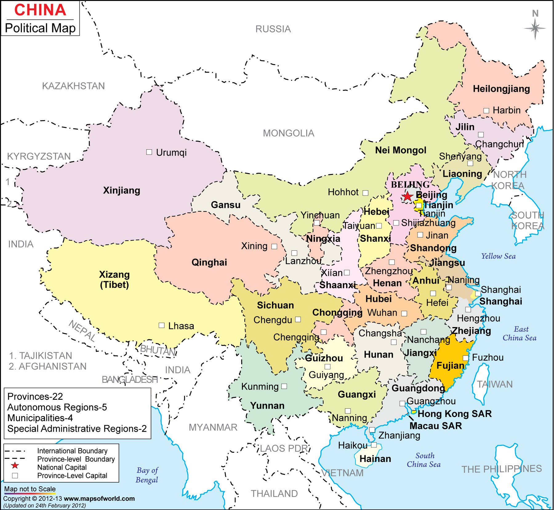
Map of China
http://www.mapsofworld.com/china/map-of-china-large.html
This is the map of China. The map shows all the provinces in China with their capitals. With different colors for different provinces, we can easily distinguish the area of the provinces. It easy to see the major cities like Beijing, Hong Kong, and shanghai. I choose this map because this is the country I come from. I'm from the city called Zhengzhou, which is in Henan province, located in the middle of China. The map gives people who do not know very much a vivid image of China. When they see this map, they would look for the major cities they know and get a rough idea of the locations of those cities. Since this is just a political map that only shows the distribution of the provinces, there is not much other information about the topographic features.
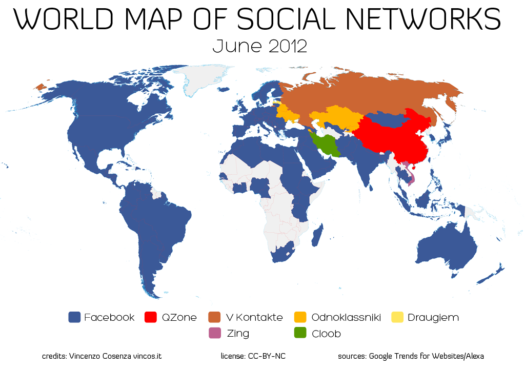
World Map of Social Networks
URL: http://www.hejorama.com/articles/the-monday-map-infographic-maps-10214/
This map shows what is the most popular social networks in different regions.Without the white area which is the region collectors do not have the data, blue makes most of the region. It is not surprise since Facebook is the most popular social network around the world. If Facebook is not blocked from China, China would have at least half to be blue. For China, it is the Qzone which dominates the market of the social networks, while another company, the Renren Inc., wants to the share the market. Also, for Russia and several other countries, many different social networks are the major players in those countries. It is interesting that this map vividly gives me a global image of the major social networks and countries they cover. As we can see, Facebook covers majority of the English speaking country since Facebook is more adaptable for people from Western country.
No comments:
Post a Comment